The common interest community known popularly as Merifield Acres is composed of developments established over time. Elected by property owners eligible to vote, the volunteer Board of Directors of the Merifield Acres Landowners’ Association (MALA) and the volunteer Architectural Committee tend to the day-to-day business of the community. Property owners in Merifield Acres acting through the various committees share responsibility for maintaining the security, roads, and appearance of Merifield Acres, thereby protecting its peaceful and wooded surroundings, enhancing property values, and preserving Merifield Acres as a highly desirable place in which to live.
The Occoneechee controlled the Buggs Island area and surrounding region from 1250 A.D. until 1676, when Nathaniel Bacon’s Rebellion drove the Native Americans out. By the mid-1700s, Lewises had become landowners in Mecklenburg. During the time of John Taylor Lewis, IV, and his second wife Elizabeth Uzelle Wardwell Lewis, the land now popularly known as Merifield Acres was known as the John T. Lewis Homeplace or Grassy Creek Farm, a cattle and tobacco farm of a little over two-thousand acres bound on the northeast and east by the Roanoke River and on the south and southwest by Grassy Creek.
The members of this branch of the Lewis family are collateral descendants of explorer Meriwether Lewis, who died in 1809. As do many families, names were interchanged throughout the generations. After serving as a naval aviator in the Pacific during World War II, Meriwether Fielding Lewis returned to Clarksville with his bride Mary Frances Thatcher to farm and continued flying.
On August 15, 1947, Meriwether Fielding Lewis bought from his widowed mother a little over one-thousand acres. The land on which he raised beef cattle and a seven-acre tobacco allotment he had renamed Merifield (Deed Book 127, Page 176), from the first syllables of his given names. The original farmhouse stood on what is now the corner of Greenbriar Place and diagonally opposite the airstrip. Outbuildings stood to the left of now Cedar Lane. A tenant farmer’s house has since been relocated to the end of Terrace Road.
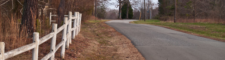
The uplands of Merifield were largely wooded with scattered clearings. The lowlands through which meandered the Roanoke River and Grassy Creek on three sides of the farm included islands, several ponds, and large trees. Because the beef cattle grazed the undergrowth clear, a person could see through the tree trunks. In these lowlands and to the left of now Cedar Lane and on the eventual airstrip, hay was grown. Along Merifield Drive can be seen remains of pack houses and ordering houses, in which dry and brittle tobacco was steamed to make it pliable for handling.
About 1949, the pine tree forest across from Oak Park was planted. Many years before the U.S. Army Corps of Engineers took over, Carolina Power and Light had planned a smaller impoundment of water on the North Carolina-Virginia border and had purchased from Meriwether Fielding Lewis’s father John Taylor Lewis land up to the 245 MSL that he leased back. The construction of John H. Kerr Dam and Reservoir between 1946 into 1952 to control floods and generate hydroelectric power altered the geography and landscape.
Known in North Carolina as Kerr Lake for the North Carolina senator who supported the project, the 50,000-acre reservoir in Virginia is called Buggs Island Lake after a small island in the Roanoke River below the dam site that was named for early settler Samuel Bugg. The Corps purchased land up to the 320 MSL, higher in some locations. The rising waters claimed a cornfield the Lewises had planted and sent spiders and snakes up the cornstalks for refuge.
Merifield’s bottom land became lake bottom. Roanoke Point appeared on surveyors’ plats. Because the Corps only topped the large trees, when the water table recedes, their trunks berth along the shoreline; when the water rises again, they float elsewhere.
The impoundment of water within a reservoir forced the Lewises to shift from farming to land development. The first lots were platted in October of 1955. In the mid-fifties, combining two separate hay fields and moving earth, Meriwether Fielding Lewis created an airstrip running up from the water. A year or so later, he built one hangar and then a second and bigger one, the concrete foundation of which remains today at the head of the airstrip.
In 1956, the Lewises built a new house overlooking the lake and alongside the foot of the airstrip. The first property parceled off from Merifield was RP 2, lot 9, given on March 14, 1957, in exchange for drilling the well for the new house. For running the wiring, Lots 19,21 were exchanged.
One particularly cold winter, the inlets froze firmly enough that the family could go ice skating. Another cold winter, about 1960, a milking cow led nineteen or so calves out onto the ice–to fall in and form a frozen mound.
On July 23, 1959, lots in Holly Point (HPT) and Maplewood Lane (MWL) were sold, also with deed-form covenants and without annual assessments. These early deeds grant to the buyers an easement to drive to their properties over Merifield. The RP 2, Lower Cedar Lane, Lots 19,21, and Holly Point deeds grant the buyers the right to use the airstrip.
The deed to the first lot sold in Maplewood Lane states: “whereas, the grantors are engaged in raising of livestock on the land on which the above-described lot is a part, the grantee agrees by the acceptance of this deed that should the wandering of livestock of the grantors over the property herein conveyed be objectionable, [the buyer] will at her own expense erect such proper fence as is necessary to prohibit their wandering on said lot” (Deed Book 168, Page 037).
Platted in 1961, Merifield 1 (MF 1) was developed by the Lewises initially. On May 7, 1962, Fielding Development Co., Inc., was formed with Meriwether F. Lewis, President, and Mary Frances Lewis, Secretary. The lots in Units RP 1, 3, 4, and 5 were sold with restrictive covenants and an annual assessment of $25.00 for road maintenance that was not, however, stipulated within the declaration itself.
On June 10, 1962, with at least 10,000 hours flight time, Meriwether Fielding Lewis died in an aircraft accident. Mary Frances Lewis assumed development of the Fielding area and initiated development of Holly Park, December 4, 1963 (HPK) (amended October 24, 1964), in which lots were sold with restrictive covenants but also without an annual assessment. (At the present time, property owners for whom the annual assessment is not mandatory may make a voluntary contribution to the Association.)
In April of 1973, Fielding Development Co. deeded the remaining unsold property to Richard C. Rathke and Robert K. McKee, land developers based in Raleigh, North Carolina. Wanting a point of contact with the Merifield property owners, Rathke and McKee encouraged the formation of a landowners’ association.
In January of 1975, the first membership meeting was held. The development envisioned by Rathke and McKee not succeeding, Mary Frances Lewis foreclosed. In June of 1976, the remaining unsold property was deeded to Merifield Acres, Inc., a corporation registered in North Carolina and headed by David S. Wilson. On July 20, 1976, Merifield Acres, Inc., filed the declaration for RP 6, in which the Architectural Committee was established and the Merifield Acres Landowners’ Association is referred to as an entity already in existence.
On January 14, 1977, Merifield Acres Landowners’ Association was registered with the State Corporation Commission in Richmond, Virginia. On September 19, 1977, MALA’s first general membership meeting was held. Between July 20, 1976, and June 19, 1979, Merifield Acres, Inc., developed the major portion of Merifield Acres (Units RP 6, RP 7 A-D, RP 8A-E, RP 9 A-C, RP 10) with restrictive covenants and an annual assessment. (Merifield 1, November 20, 1977 [MF 1], in exchange for accepting the Merifield Acres, Inc., restrictive covenants, has a fixed annual assessment; RP 8A, May 25, 1977, amended June 15, 1989, has an amended assessment structure.)
In August of 1989, Merifield Acres, Inc., was forced into a Trustees Sale. On December 4, 1989, Mary Frances Lewis reacquired the unsold properties via public auction. On March 1, 1991, she declared the restrictive covenants for RP 11, land that at one time had been set aside for a campground. (These covenants are identical to those of RP 6-RP 10.) November 30, 1978, July 24, 1979, August 20, 1979, Merifield Acres Inc., and March 30, 1979, September 15, 1996, Mary Fran Lewis had deeded to MALA some 12.5 miles of roads, for which the maintenance and upkeep are the Association’s responsibility.
On July 24, 1979, Merifield Acres Inc. had deeded to MALA the tennis court and portions of Oak Park. On May 6, 1992, Mary Frances Lewis deeded to MALA land neighboring the tennis court, additional portions of Oak Park, the upper portion of the airstrip, and two lots at the head of the airstrip (Unit RP 8E, lots 171-172) — so long as the airstrip remains available as an airstrip.
Authority to enforce the restrictive covenants of Units MF 1 and RP 6 through RP 11 resides with MALA and its membership. Authority to enforce the restrictive covenants of Holly Park and Units RP 1, 3, 4, and 5 was transferred by Mary Frances Lewis to the Merifield Acres Landowners’ Association Board of Directors by declarations recorded at the Mecklenburg County Courthouse on March 4, 1983, and March 24, 1983, respectively. Persons using the roads and common areas and facilities of Merifield Acres are required to abide by the restrictive covenants of Merifield Acres, Inc., and the policies of Merifield Acres Landowners’ Association.
Meriwether Fielding Lewis had envisioned that Merifield would be a community of people interested in aviation who owned their own aircraft and would use their airplanes and the Merifield airstrip for daily or weekly commuting to their place of work. The vision turned out not to correspond with the way people wanted to work and live and commute.
Over time, the aviation aspect of the community diminished in importance, while the recreational aspects and peaceful living in a beautiful natural environment became more important. Although there has always been some use of the facility, MALA having maintained the airstrip throughout the years, as of this writing there is an increasing and promising interest in more active use of the airstrip.
On the Roanoke Point promontory formed by Buggs Island Lake/Kerr Reservoir resides the common interest community known as Merifield Acres that contains approximately 719 platted lots. As of September 21, 2008, there are 295 homes with an additional three under construction.
The brass plaque on one of the main entrance brick columns states Merifield Acres. The brass plaque on one of the more modest brick columns leading to the home beside the airstrip states Merifield. Of the original beef cattle and tobacco farm known as Merifield, there remains the home, the end of the airstrip toward the water, a twelve-acre parcel, lots within Merifield Acres, and several wooded areas.
Merifield farm remains here and there on edges of Merifield Acres and within Merifield Acres. In the course of these several decades and in various measure, untold and unsung residents within Merifield Acres have voluntarily given of their time and energy, talents and means, toward the evolution of a common interest community in which it is a pleasure to live.
Mary Fran Lewis interviewed by Martha Day summer of 2007 with the assistance of documents previously collected by Lee Hummel, slightly revised September 2008